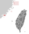
File:ROC Fuchien.png
Jump to navigation
Jump to search
ROC_Fuchien.png (362 × 425 pixels, file size: 11 KB, MIME type: image/png)
File history
Click on a date/time to view the file as it appeared at that time.
| Date/Time | Thumbnail | Dimensions | User | Comment | |
|---|---|---|---|---|---|
| current | 19:09, 25 September 2019 |  | 362 × 425 (11 KB) | wikimediacommons>Geographyinitiative | The upload is an exact duplicate of an older version of File:ROC Fuchien.png. Restoring original. In the 2011 version, the subjectively drawn oceanic boundary for Lienchiang County (the Matsu Islands) doesn't reach around Dongyin Township- absurd. Also, the Dongding Island area is omitted in the 2011 map, equally absurd. Dongyin is too close to the edge in the 2011 map, whereas in the 2005 map you can see some of the areas north of Matsu- th... |
File usage
The following page uses this file:

